Google Maps is an invaluable tool for navigating and finding places in the world around you. But the mapping service doesn’t excel in all areas, and bike navigation is one of them. With more and more cities around the world finally taking cycling infrastructure more seriously, Google seems to have realized it’s time to properly help cyclists find the best routes to their destinations. In Berlin, Germany, the company has even teamed up with the local government to do just that.
Google already announced last summer that would add a lot more information to its bike navigation. Specifically, the company promised that to provide details on elevation, how much car traffic you are likely to encounter, whether there are any steep hills or stairs to complicate your route, and what types of roads and bike lanes you can expect (major roads vs. local streets, protected lanes vs. shared paths). These new cycling directions should now be available in “hundreds of cities where cycling directions are available,” according to Google.
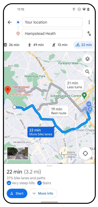
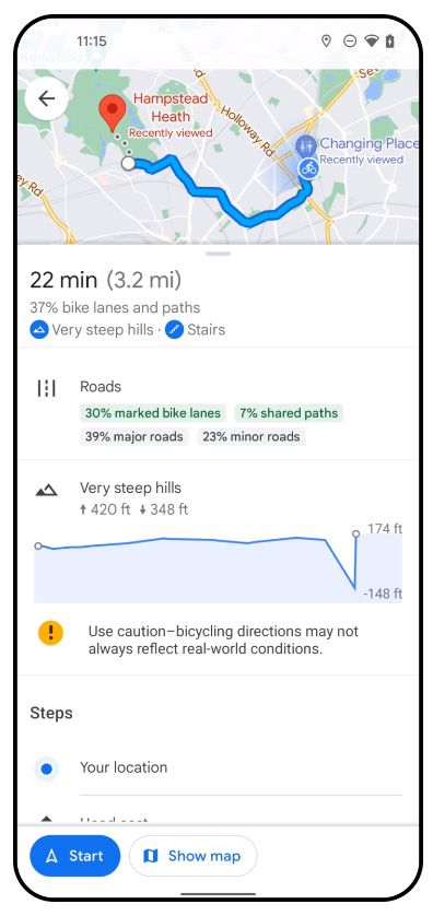
But how exactly does Google Maps source this cycling information? In the case of Berlin, the company teamed up with the local government to provide cyclists with detailed information about their routes throughout the city.
As a government official told the German newspaper Der Tagesspiegel, “We are in exchange with Google to find out which data sets are useful and needed in bike routing. This includes the bicycle road network, the road categories and, in the long term, the bicycle network.” Almost all the datasets provided to Google are freely available, so competitors should have no difficulty accessing them, either. The Berlin Senate's rationale for working with Google is that it Maps is the most widely used service, meaning many users can quickly benefit from improvements.
The Berlin Senate also claims that this collaboration is special: "Berlin is one of a few cities worldwide where Google is testing new features." In Berlin’s case, this means some of the data you can now see while navigating is provided by the Senate. That includes details about what kind of roads you can expect, though this is supposed to be just the beginning.
Many cyclists rely on specialized apps that pull data from multiple sources to find optimal routes. Many of those apps also allow them to enter specific preferences, such as avoiding major roads or streets with dangerous and uncomfortable cobblestone. The quality of those services may vary widely depending on where in the world you want to use them, though. Google Maps has the potential to make this easier, allowing you to quickly find your way around on a bike no matter where you are in the world Right now, Google Maps lets you compare different routes and choose the one you think is better, but you can't pick specific preferences like with car navigation.
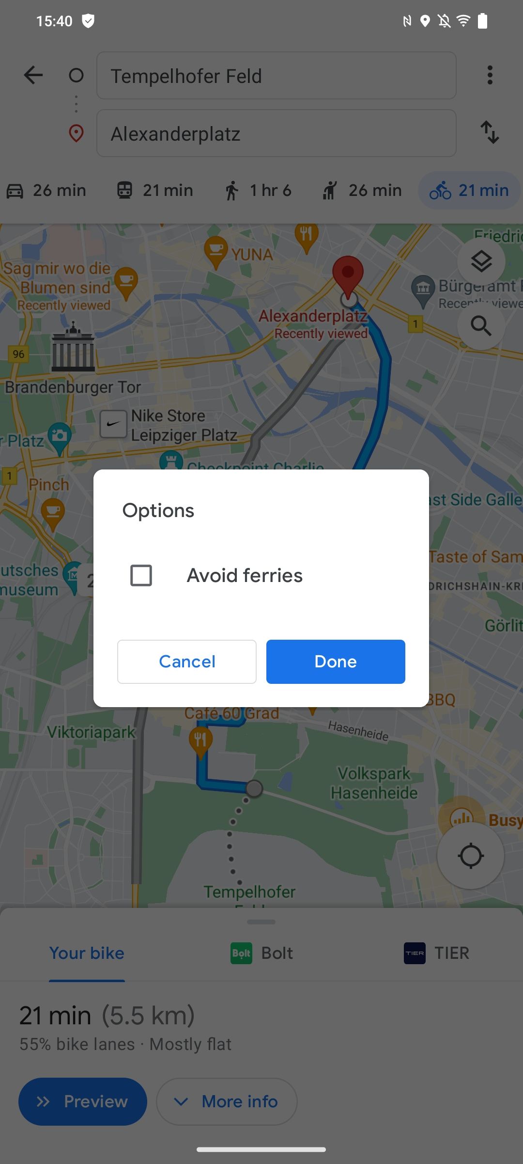
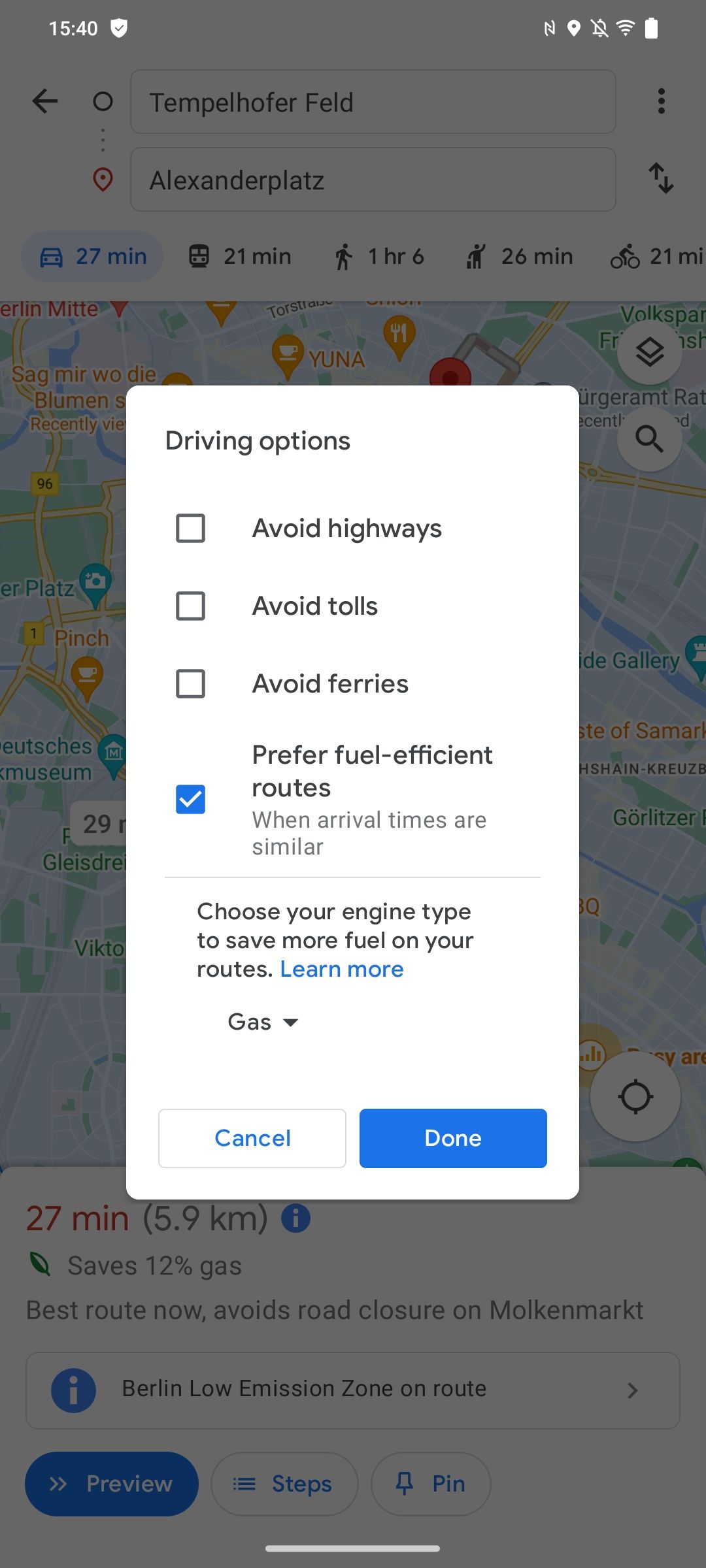
Cycling preferences vs. driving preferences in Google Maps
There are a lot of other aspects for Google to improve, especially in Berlin. For example, the navigation system currently doesn’t correctly identify recently introduced "bike streets," small streets that have been rededicated to bikes rather than cars. Still, it’s interesting to see how cities can work with navigation apps to the benefit of everyone using these services—while also making sure that the infrastructure built by governments is actually being used.
When we asked Google if it was planning similar partnerships in other parts of the world, the company simply referred us to its blog post from last summer, which outlined what new cycling features were introduced, but not how they were sourced. As for Berlin, a Google spokesperson told us, "We are very pleased to work with the State of Berlin and the Berlin Senate Department for Environment, Mobility, Consumer and Climate Protection to make navigation for cyclists in Berlin more helpful, easier and more attractive. Users will receive more information about suggested routes and alternatives, giving them the opportunity to choose the right route for their riding style."

