Google constantly tweaks its Maps program to make it more useful for users (and, admittedly, all the businesses that pay to advertise in the app and on the web). According to a message sent to members of the Google Maps preview program, the next major feature to be added will be automatic display of prices for tolls on roads, bridges, and other potentially expensive additions to your navigation route.
Confirmation came from a member of the preview program who was instructed to take a survey in order to direct the Maps development team on how best to implement the feature. According to the message, toll prices and perhaps totals would be displayed along a driving route before the user selects it, allowing them to choose between saving time or money.
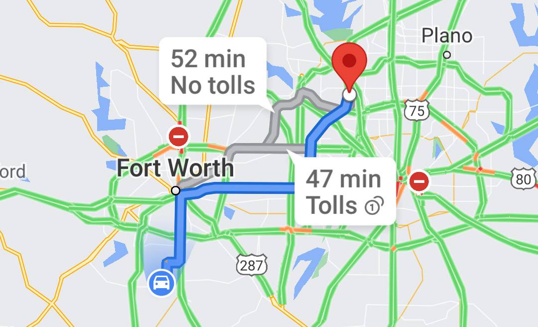
At the moment Google Maps identifies the presence of toll roads, both in the general map and in navigation routes (see above). But specific toll prices aren't currently in the app, even for members of the preview program. It's possible that Google is porting yet another feature over from Waze, a mapping app it acquired way back in 2013 — Waze began estimating tolls three years ago. Hopefully it'll show up soon, as it could be a huge boon to anyone who has to drive irregular routes or who's trying to get around a new city inexpensively.