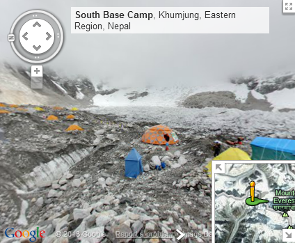
Have you ever wanted to scale a giant mountain? It's a really cool thing to do that challenges you to reach your peak physical condition, invest heavily in gear, and the payoff is joining a tiny percentage of the population that can say they've seen the world from one of its highest points. Or you could just go to Google Maps, now that the company has added images taken from the peaks of the Seven Summits, the highest mountains on each of the seven continents.
The company sent several of its engineers to scale some of the highest mountains in the world and bring back Street View (can we really even call it that at this point?) data that you can now explore. Sites like Uhuru on Kilimanjaro, Elbrus in Russia, and even the world-renowned Everest Base Camp.
Google continues to digitize and archive the entire world and this addition to Google Maps, which can be viewed on the desktop and mobile, is just another step in that direction. It's a little overwhelming to know that you can explore places that, for most of human history, have been entirely inaccessible right from your computer.
Google also had a Hangout On Air to introduce the new imagery, which can be found here:
Source: Google