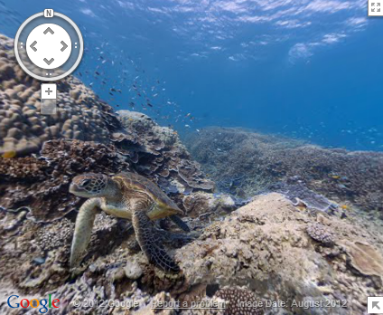
Street View can be used to see the world in Google Maps, but - up until now - users were forced to stay on land. That all changes today, as Google has added the very first under water panoramas to Google Maps - and they started with The Great Barrier Reef.
[EMBED_YT]https://youtu.be/7syWPIZt9B4
[/EMBED_YT]
In a post on the Lat-Long blog, Google highlights some of the more notable things to check out, including a close-up of a sea turtle with a school of fish, a majestic manta ray, and - probably the most beautiful of all - The Reef at sunset.
There's a lot more to explore along The Reef, so pick a spot and enjoy the view.