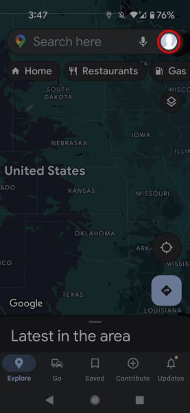
If you wanted to go somewhere new before the invention of GPS apps, you had to unfold a large sheet of paper covered with names and symbols; then, after you found your way, you either wrote down your intended path on paper or committed your route to memory. Today, we have Google Maps (and phones you can unfold!), which helps a billion people a month find out where they are and gets them where they want to go.
There's more to Google Maps than getting directions or finding a sushi restaurant that's open at 9 p.m. Here are 10 useful and little-known Google Maps tricks and features.
We used an Android phone to walk through our Google Maps tips. If you use an Apple device, Google Maps for iOS is similar to the Android app, so you'll have no problem following along.
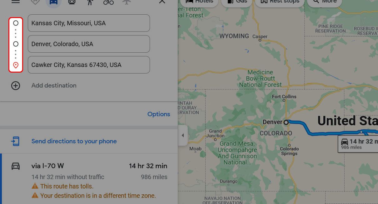
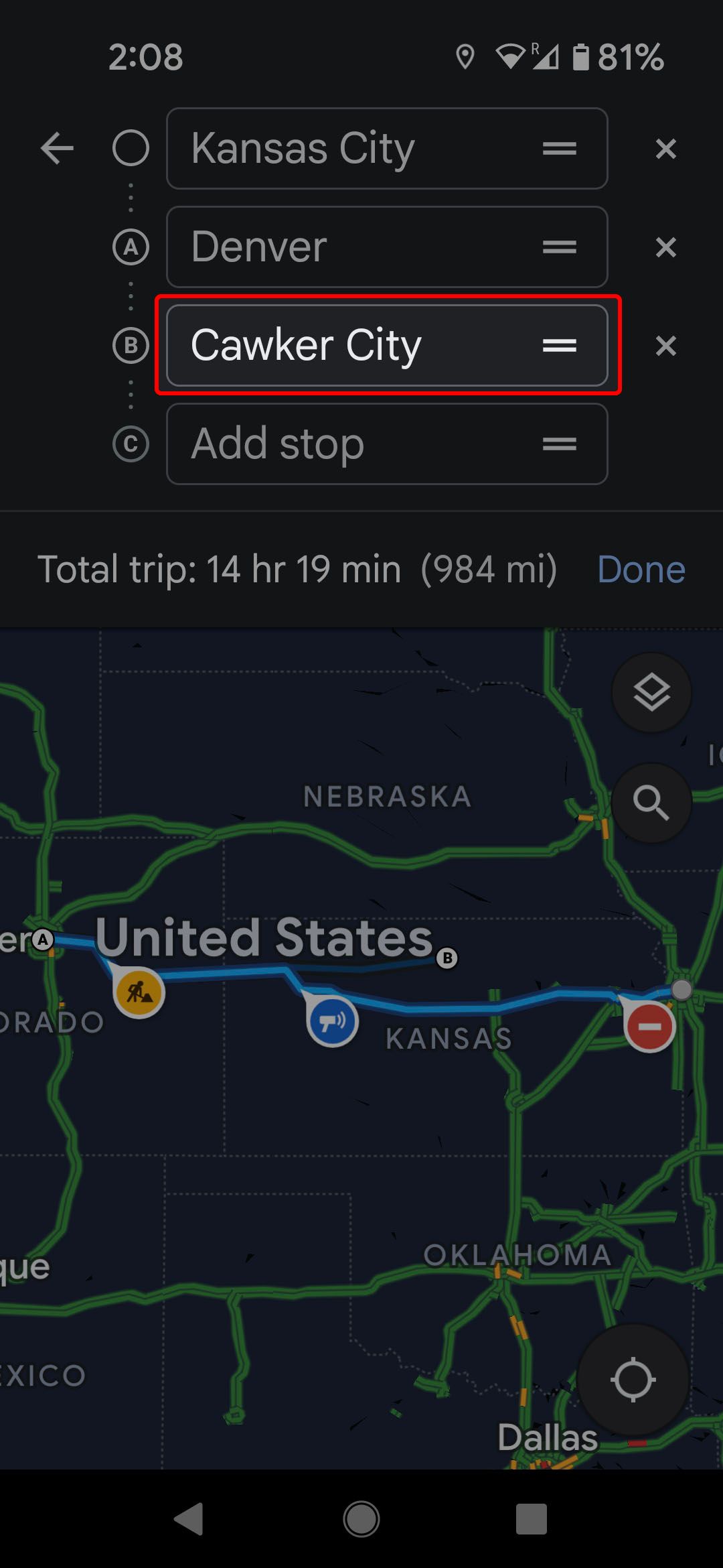
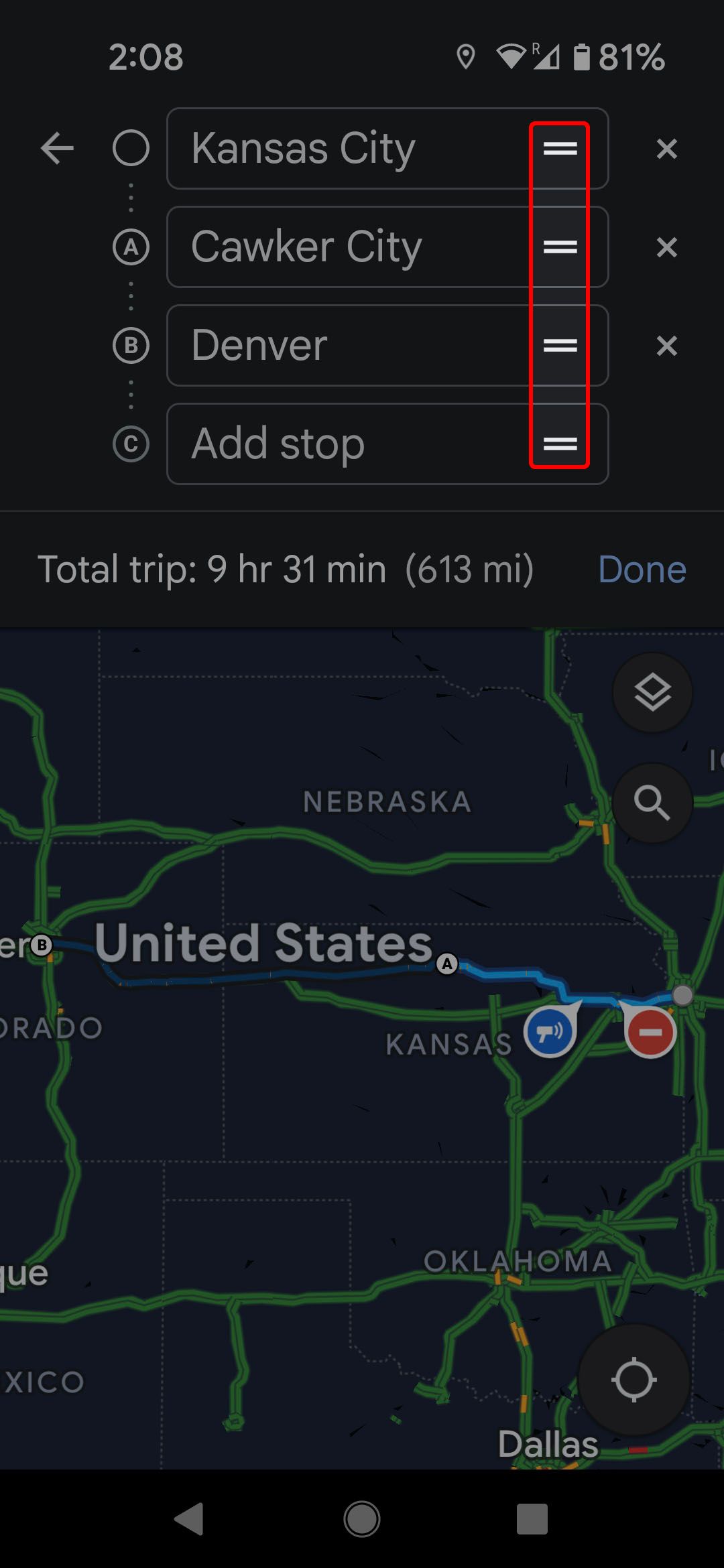
Add a stop in Google Maps
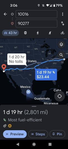
Getting from point A to point B with Google Maps has been part of the base functionality of the service since it was exclusively on desktop browsers. But you can add more than one destination to your trip. If you're going from Kansas City to Denver, for example, plotting a stop in Cawker City to see the World's Biggest Ball of Twine is a breeze.
On the desktop
-
Click Add destination.

-
Enter a new trip destination.
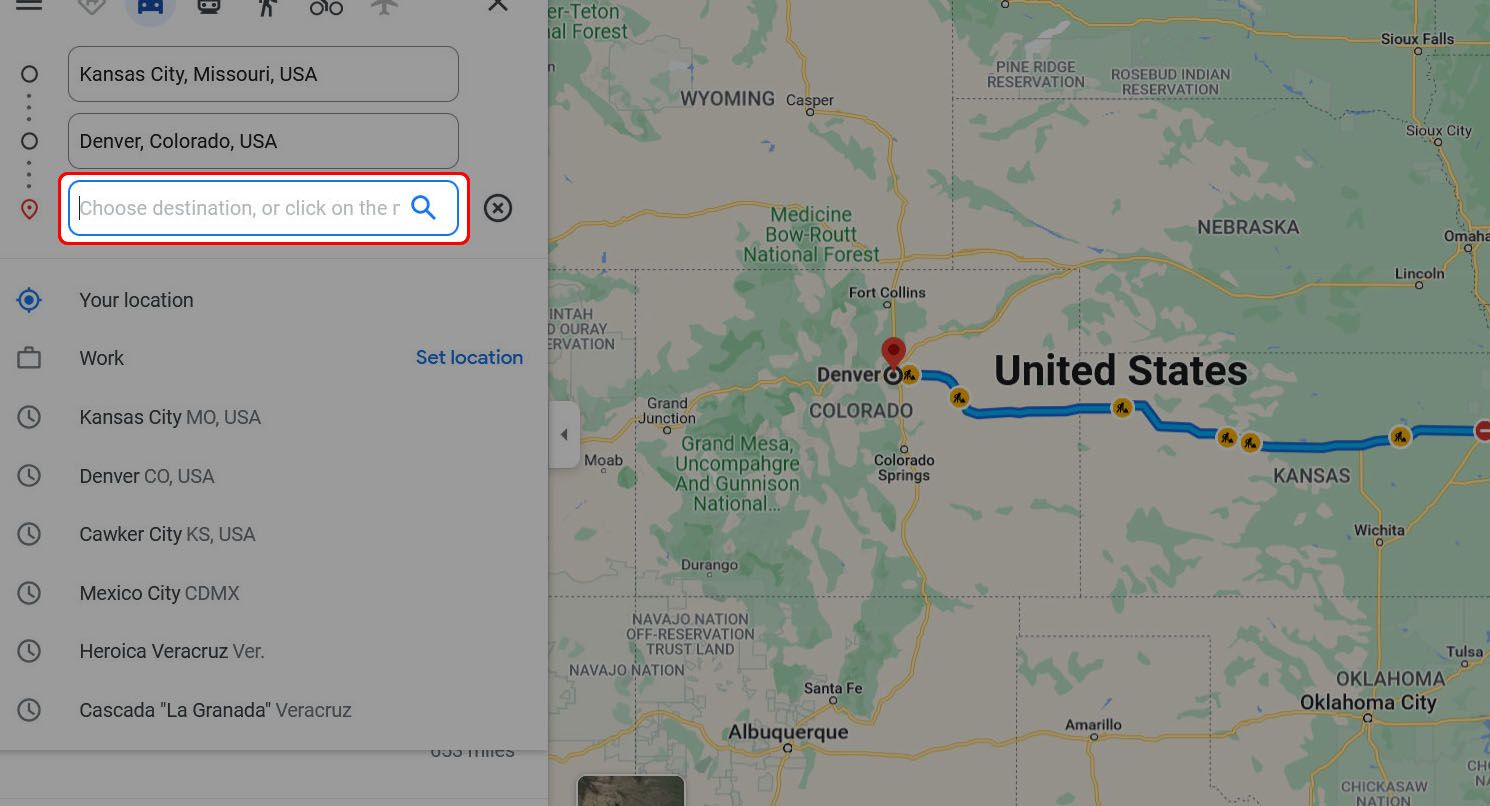
-
To reorder your stops, click and drag to the left of the destinations.


On your Android phone or iPhone
- Open Google Maps.
- Tap the three-dot menu.
- Select Add stop.
-
Enter a new destination.
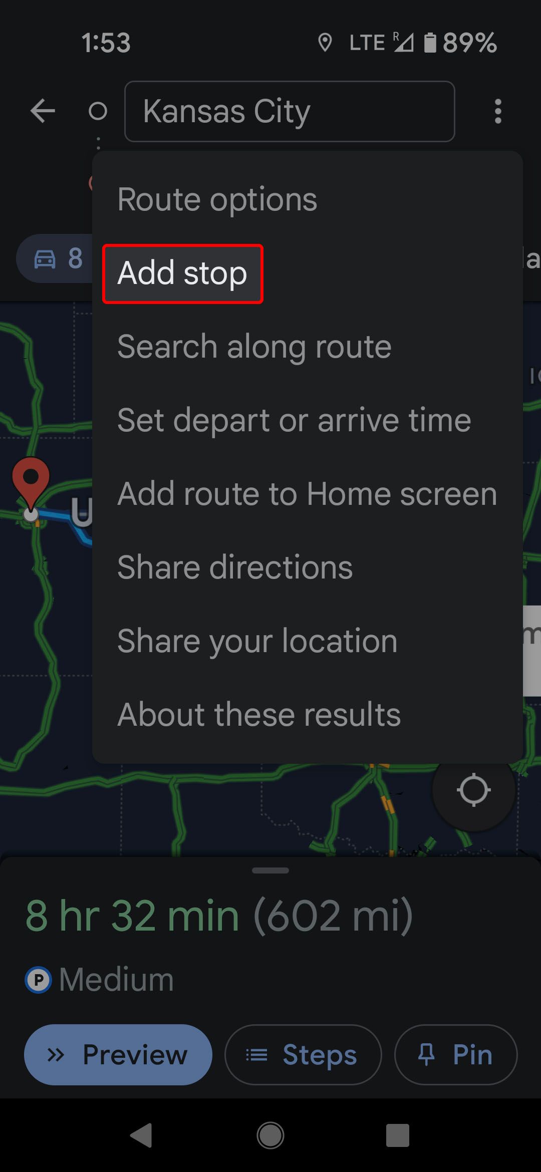
-
Touch and drag the two-bar icon right of the stop to reorder.


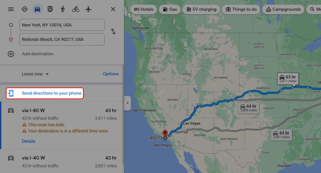
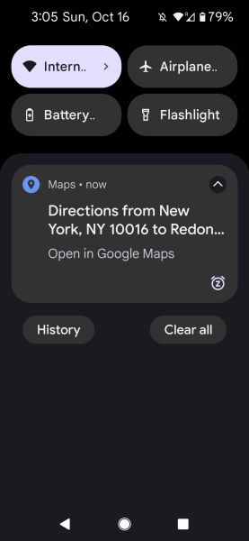
How to send directions to your phone
One of the great things about Google Maps is its seamless interface between its browser and mobile applications. The best example is planning a route on your computer and sending it to your phone.
-
Once you've plotted your route, click Send directions to your phone in the left panel.
-
Choose whether you want the directions sent as an email, a text message, or through your Google account.
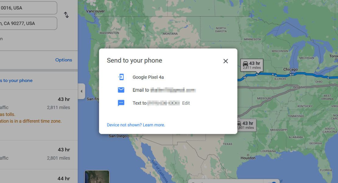
- If you selected text message or email, you're sent a link to click to open the app and display the route.
-
If you sent it to your phone via your Google account, you'll receive a notification on your device that opens the Google Maps app and loads your route.


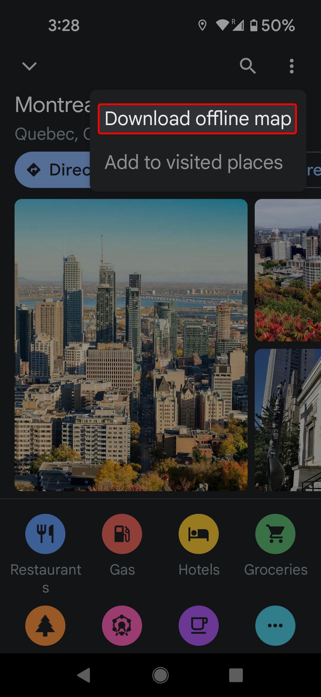
Access Google Maps offline
There's always a chance you could be left without coverage while you travel. To overcome this, don't give your hard-earned money to Big Map. Instead, download a map for offline use.
- Open Google Maps.
- Search for a location on your phone.
- Touch the name of the city or drag up from the bottom of the screen.
- Select the three-dot menu.
-
Tap Download offline map.
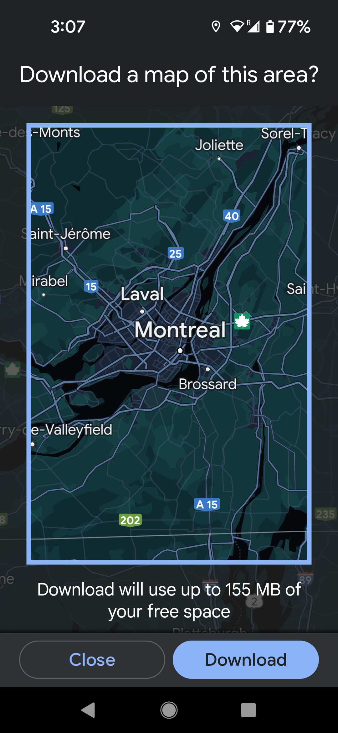


When traveling internationally or taking a long road trip, download maps for the areas you plan to visit. Carriers often have limited international coverage, and some Android phones have limited band support by region.
Maps shows you the area it will download. You can zoom in or out to decrease or increase the area saved and drag to change the area. At the bottom of the screen, you can see how much storage the map takes up on your phone.
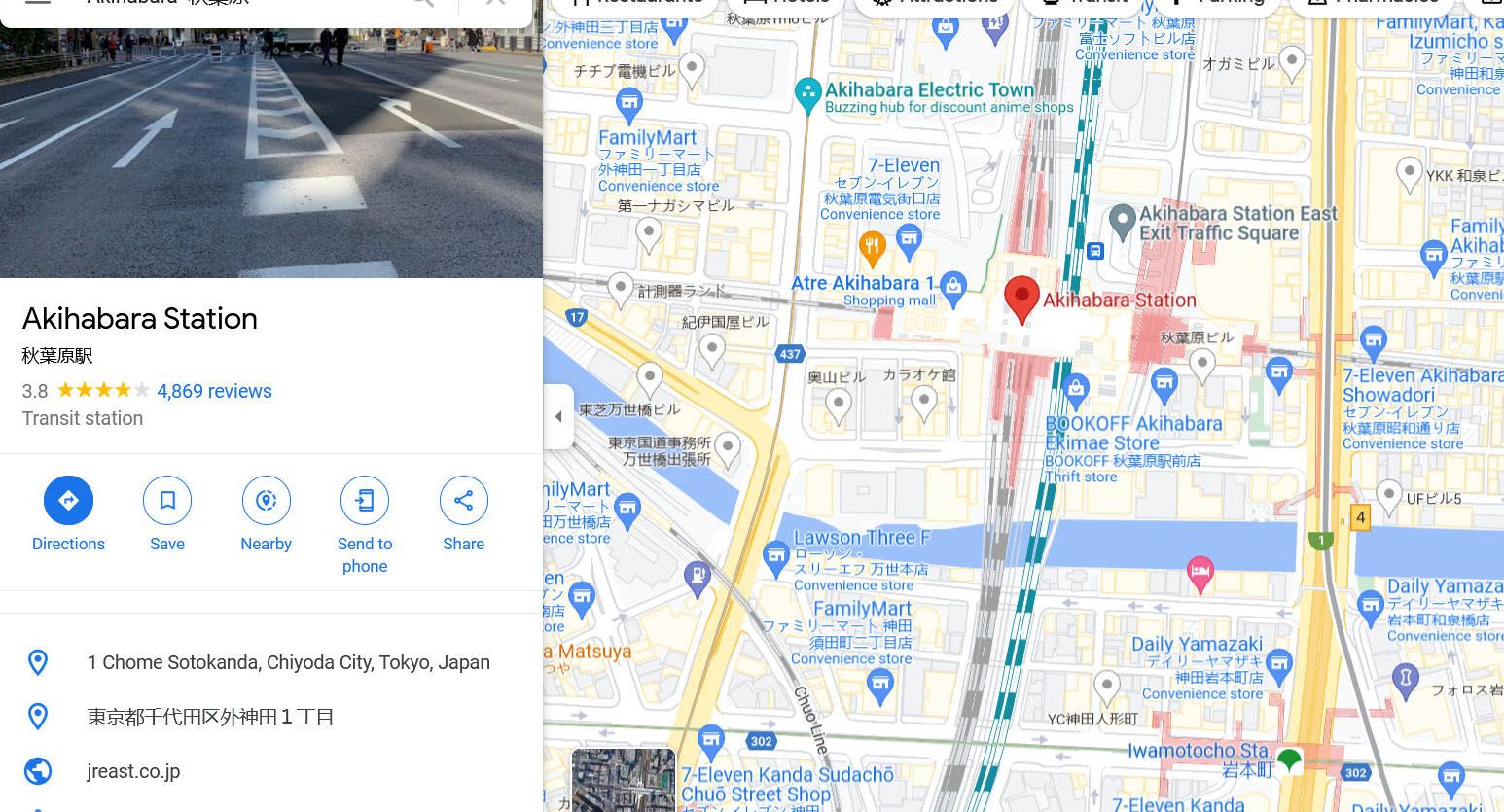
Get real-time location info on Google Maps
Traditional maps are fixed in time, forever showing what was. One of the advantages of Google Maps is that it's updated constantly. And not only with new roads and business information. It also shows the current traffic, so you can use a shortcut to get where you're going or give your friends an accurate ETA.
On the desktop
-
Hover over the Layers icon in the lower-left corner.
-
Click the Traffic icon.
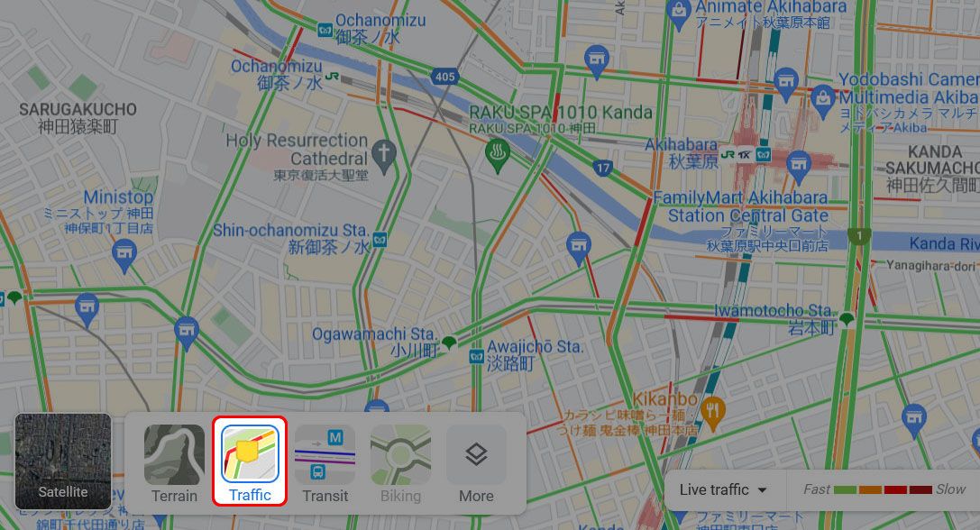


Green is for light traffic, yellow is for medium traffic, and red is for heavy traffic.
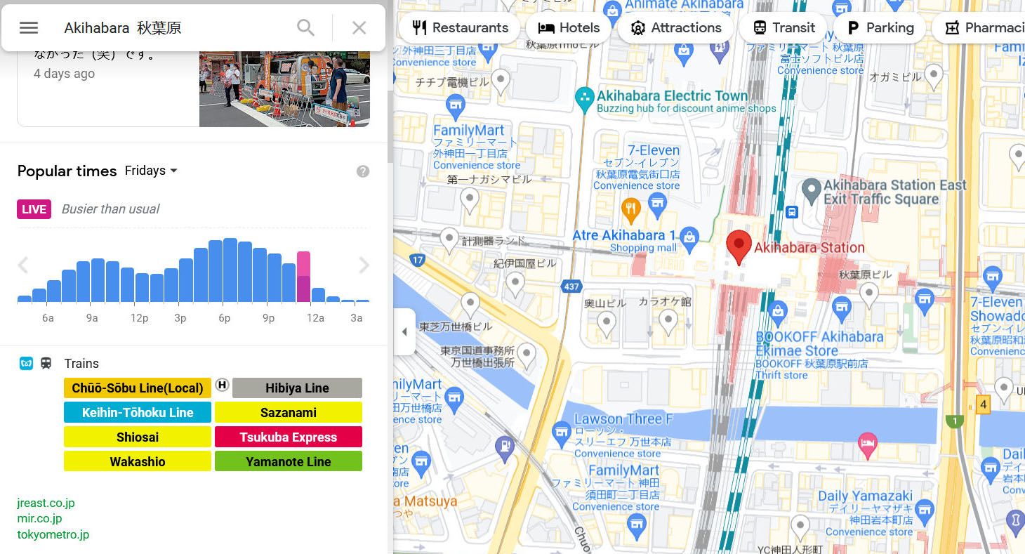
To see how busy a business or public space is in your browser:
-
Select a business or location.
-
Scroll down the side menu to Popular times.


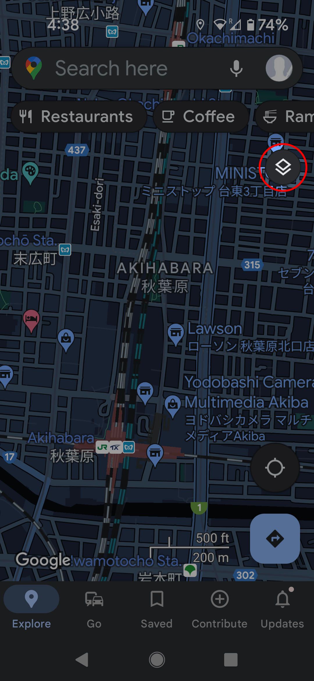
On your Android Phone or iPhone
- Open Google Maps.
- Tap the Overlay icon in the upper-right corner.
-
Tap the Traffic icon.
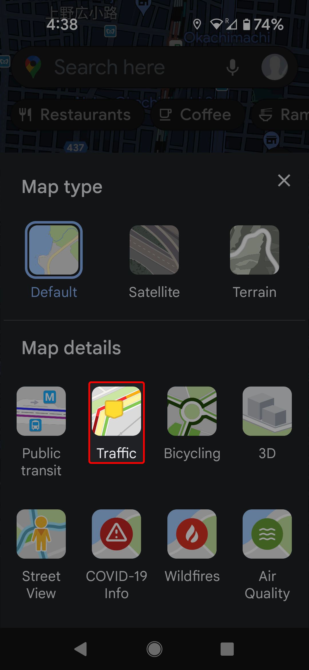


Green is for light traffic, yellow is for medium traffic, and red is for heavy traffic.
To see how busy a business or public space is on your phone:
- Tap a location.
-
Tap the Live information below the name of the location.
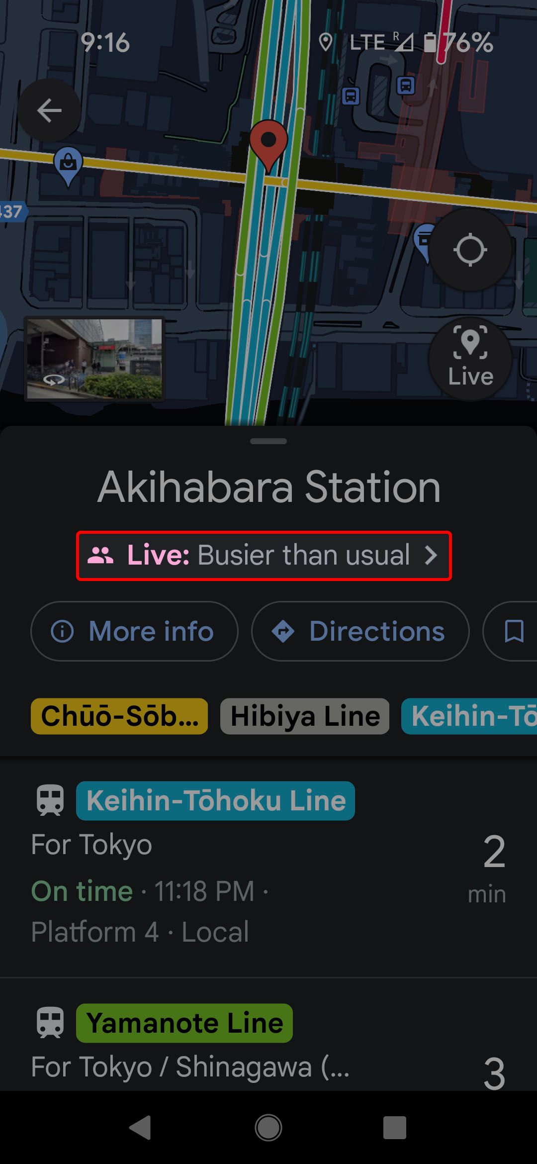
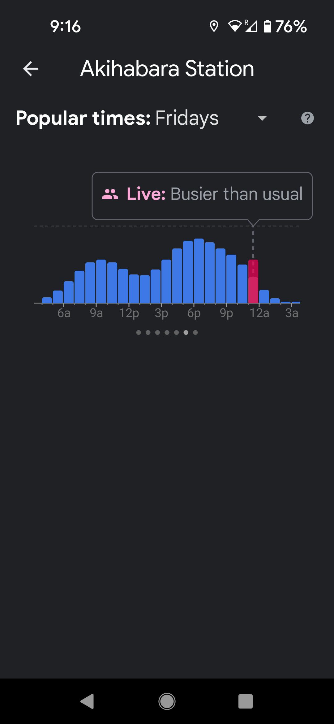


Some places show live crowd data, while others show typical crowd information.
How to filter restaurant results based on dietary restrictions
What good is it to take the time to find a restaurant that appeals to you and doesn't have a three-hour wait if they don't have food you can eat? You can nip this problem in the bud with a few taps on your smartphone.
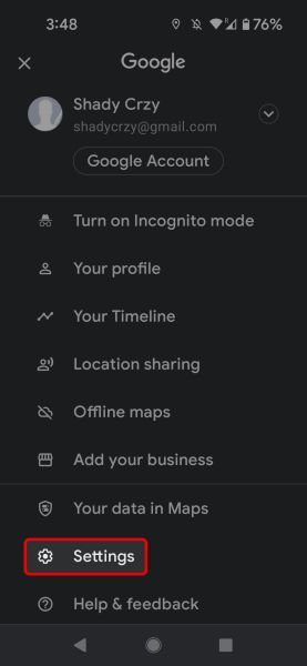
- Touch your profile icon in the upper-right corner.
-
Select Settings.
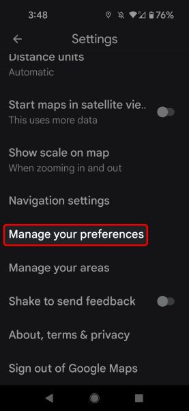
- Tap Manage your preferences (you'll have to scroll down a bit).
-
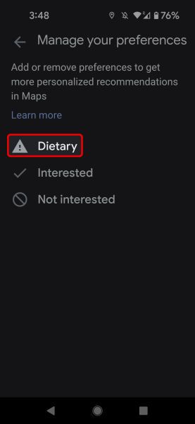
Tap Dietary.
-
Select your dietary restrictions.
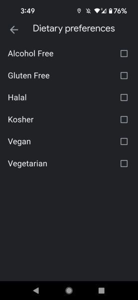


Now when you search for restaurants, Google doesn't show restaurants that can't accommodate your diet.
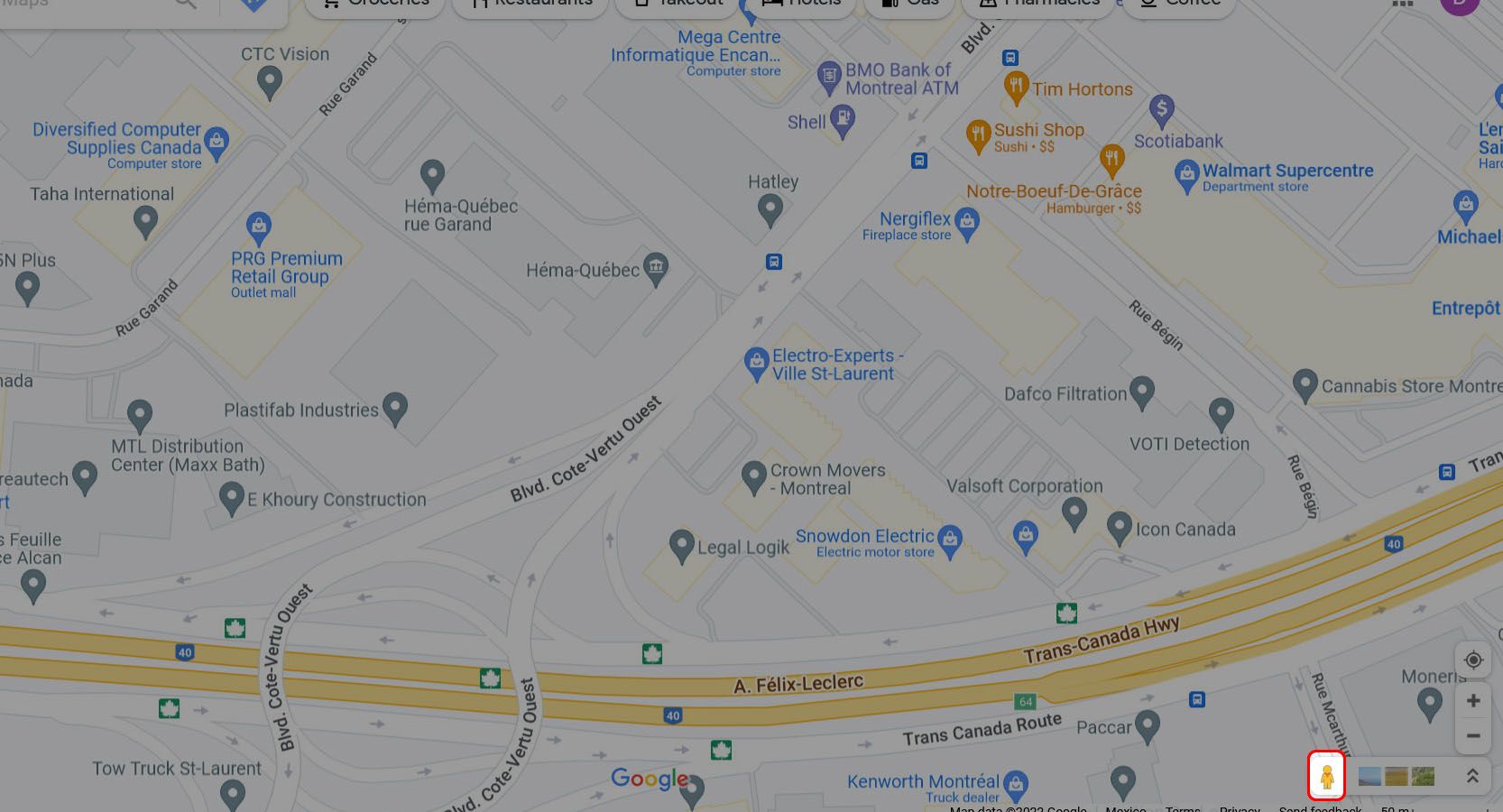
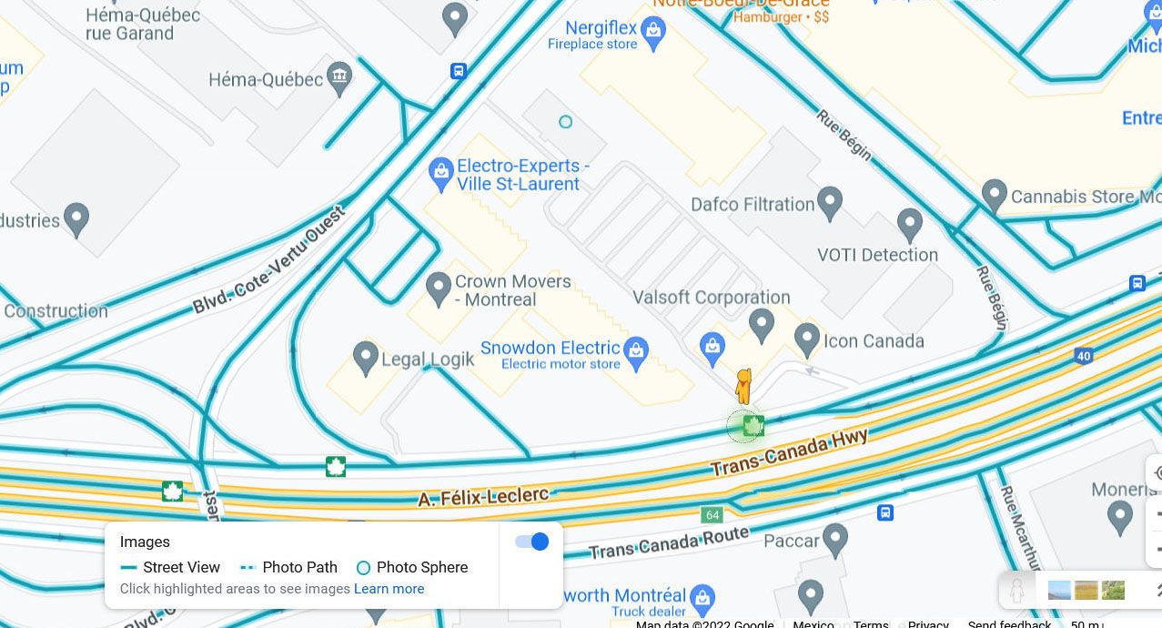
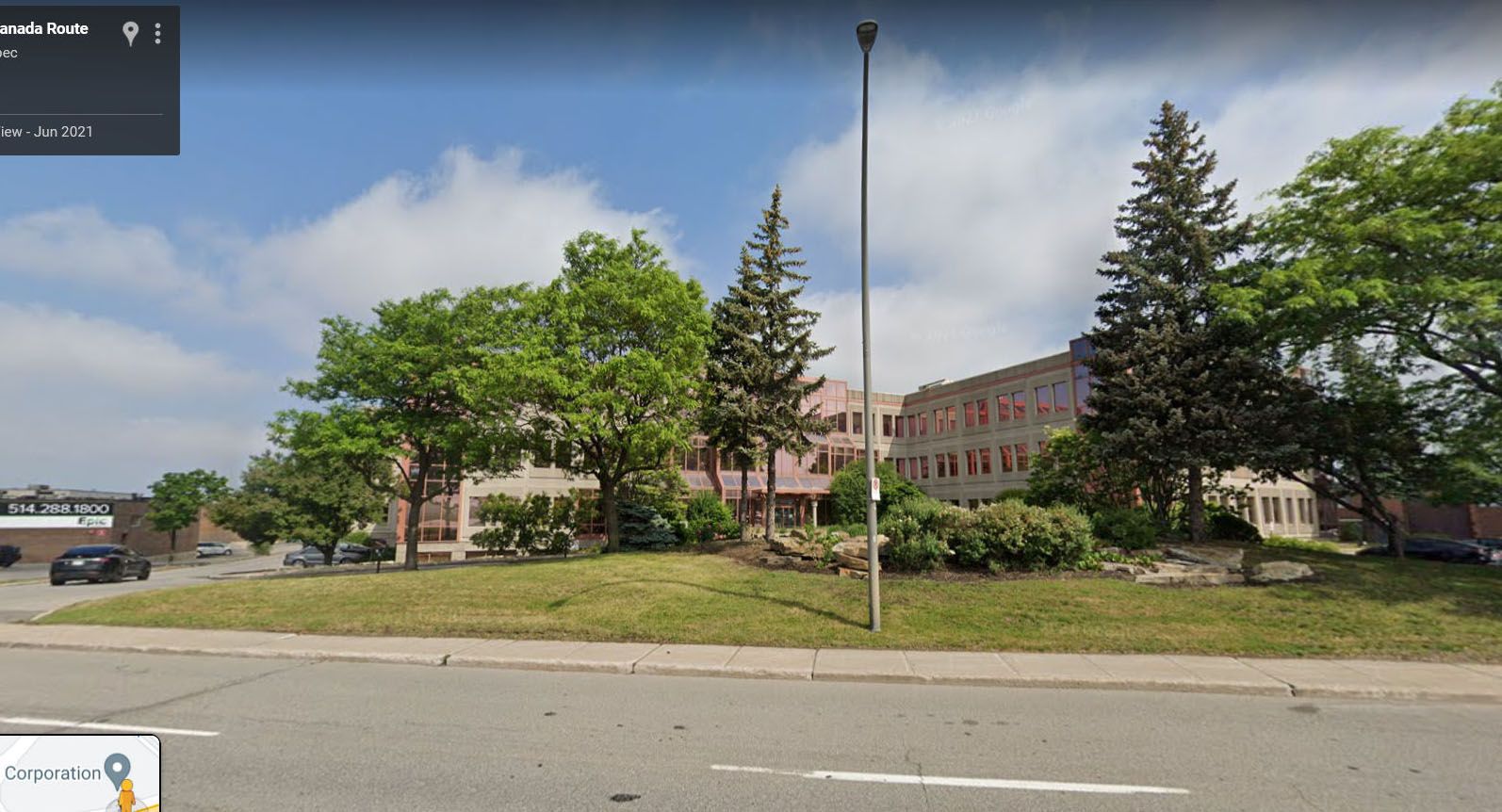
Let Pegman show you the street view on Google Maps
Sometimes, a bird's-eye view isn't enough to get where you need to go. You may need to be on the ground to find your destination or make sense of that tricky intersection. Instead of driving around in circles until you figure it out, use Street View to scout the area ahead of time.
On your browser
-
Locate the Pegman in the lower-left corner of the window.
-
Click and drag it to the location you want to view from street level. You can only drop it on roads with a blue overlay.
-
Maps shows you the view from the street.


On your Android Phone or iPhone
On mobile, there is no Pegman. However, Street View is still accessible.
- Open Google Maps.
- Tap the Layers icon in the upper-right corner.
-
Select Street View.
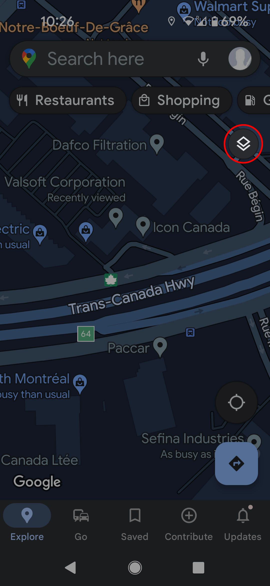
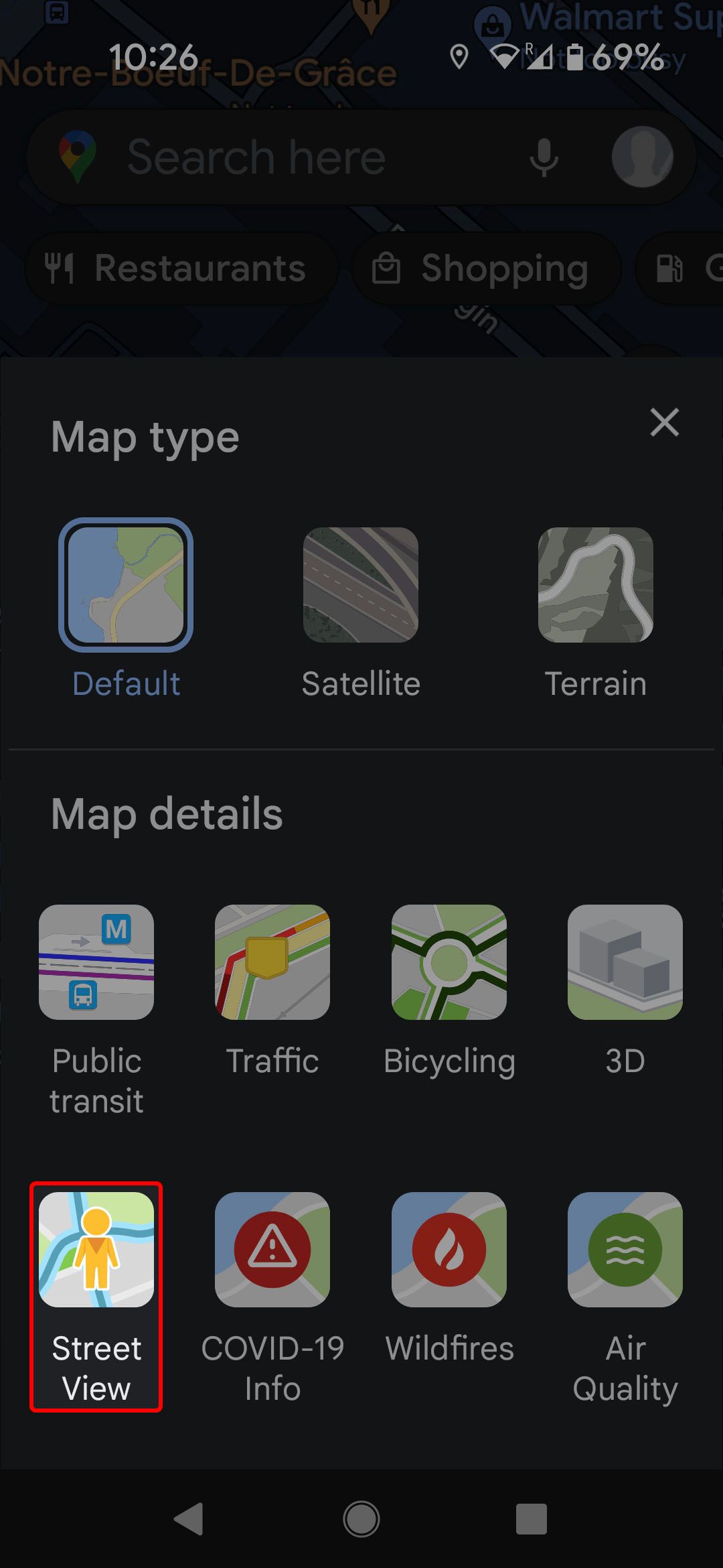
- Close the Layers menu.
-
Tap the map where you'd like to see a street-level view.


On mobile and desktop, click or touch and drag to change your view or click or tap to change your location.
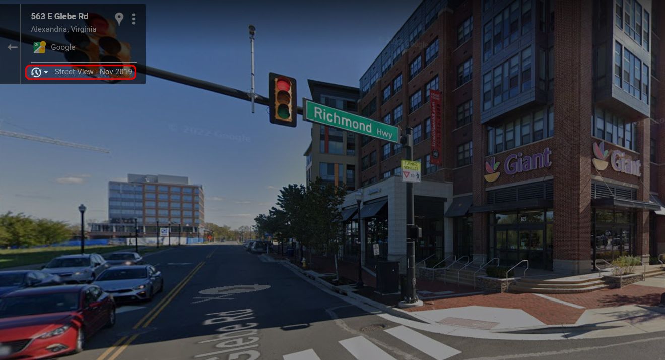
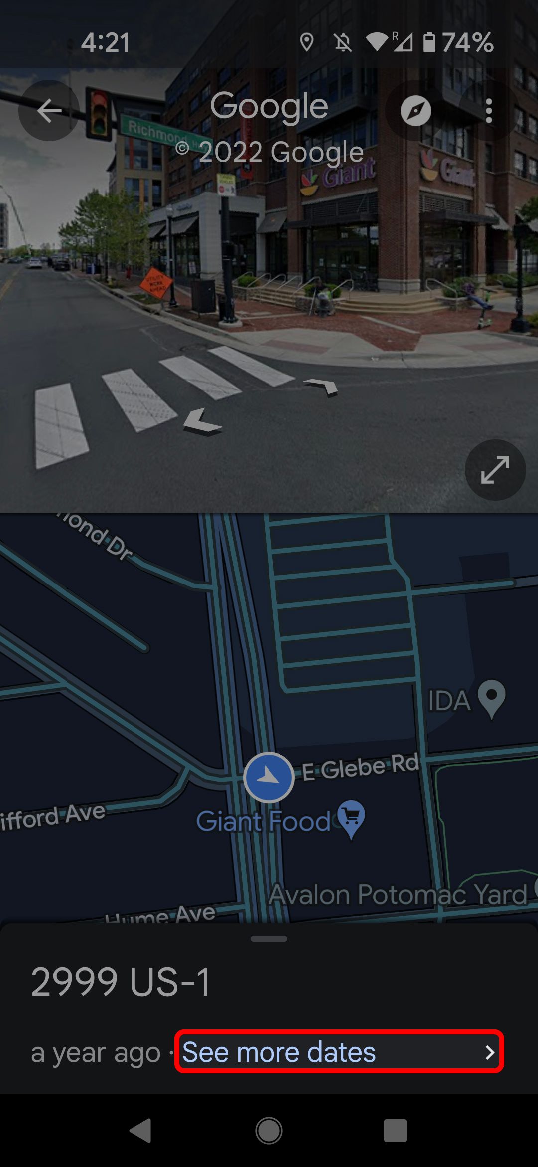
How to view older Street View photos
The Google Street View team has been recording roads for the past 15 years. For many locations, you'll find more than one photo of a location. The process to see the holder Street View data is similar on a browser and mobile.
- Find a location in Street View.
-
On the web, click on the clock icon near the upper-left corner.
-
On mobile, touch See more dates at the bottom of the screen.
-
Select the date you'd like to see the Street View of.
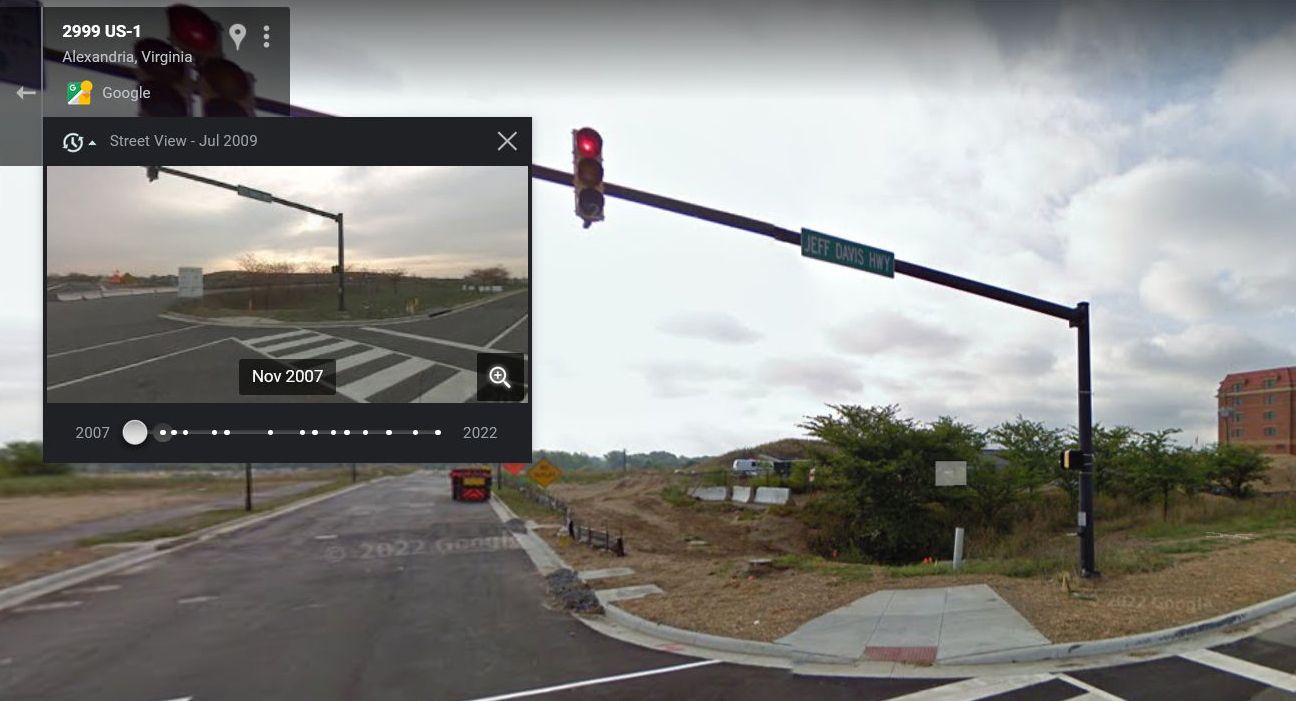


Welcome to the past, Marty! Just be careful if you go to any school dances.
Find gas stations on Google Maps
Google Maps is an amazing tool for improving your quality of life while driving. It's also a good tool to help you keep driving by showing you where the nearest gas stations are. On a desktop, click the Gas button at the top of the window.

On Android and iPhone, the button is there. Swipe the top menu bar to the left to see it.


Depending on where you're looking for gas, Google Maps may show you how much gas costs at the different gas stations.

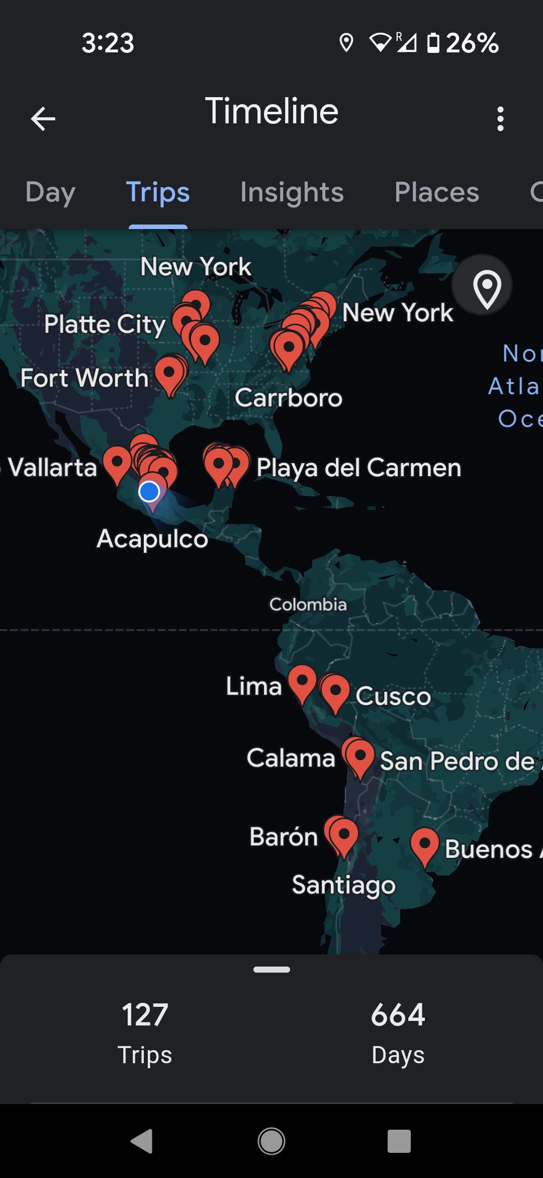
View your location history on Google Maps
Google Maps is great for finding where you want to go and planning how to get there. It also keeps track of where you've been. Although that straddles the line between "hey, that's neat" and "wow, that's creepy," there's a nostalgic pleasure in looking back on a year or more of travel.
On your desktop
-
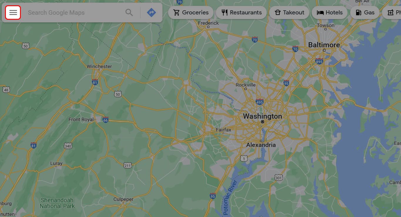
Click the three-bar menu in the search bar in the upper-left corner.
-
Select Your timeline.
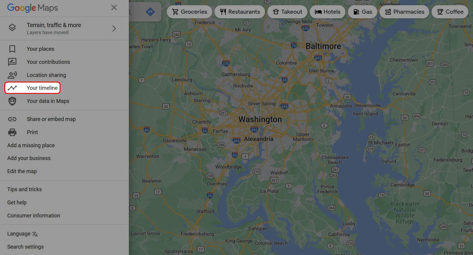


From here, you can see an overview of everywhere you've been.

If you want to get more granular, select a specific year or month. If you choose a day, Google shows you its best guess for the route you took on that day's travels.

On your Android phone or iPhone
-
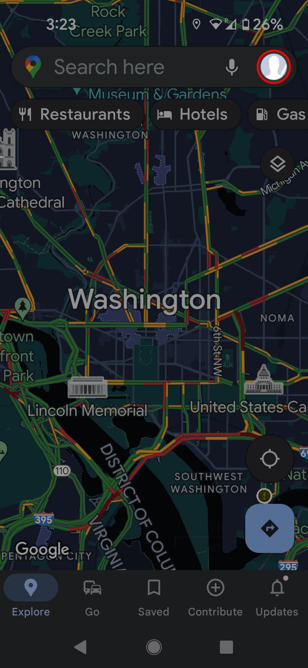
Tap your profile icon in the upper-right corner.
-
Touch Your Timeline.
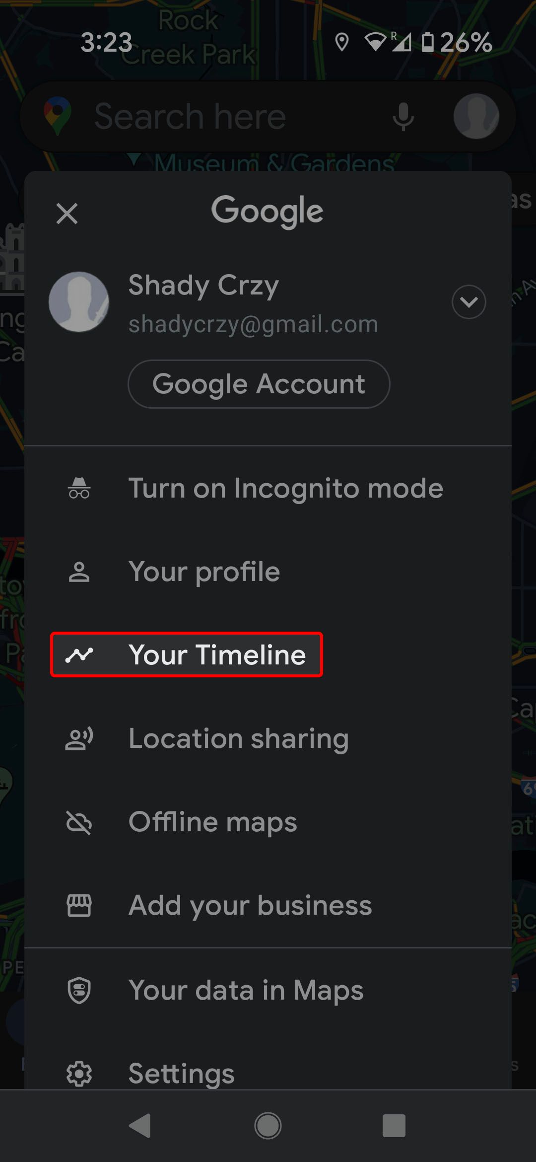


The Google Maps app has a few more options that you can play with. Drag the menu at the top of the screen to see them all.
Save your parking spot on Google Maps
Driving somewhere is the easy part of any trip. The challenge begins with remembering where you left your car. Whether you left it in a parking garage downtown or baking in the sun in a far corner of your local outlet mall, Google Maps remembers where you parked your car.
In the Google Maps app
- Tap the blue dot that shows your current location.
-
On the menu that pops up, tap Save parking.
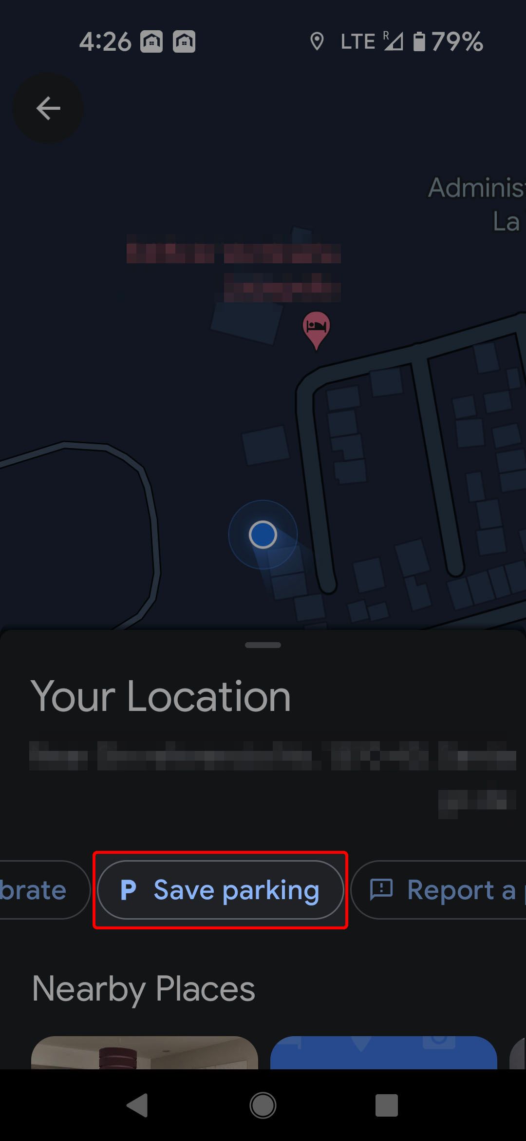

Google Maps places a yellow pin on the map to show you where you parked. You can make notes about where you are and mark down when you parked. If you want to let someone else know where you parked, there's an option to share your parking location.


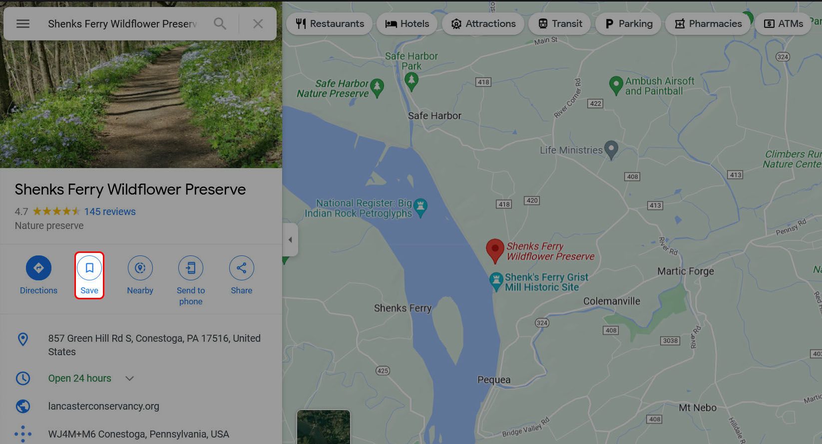
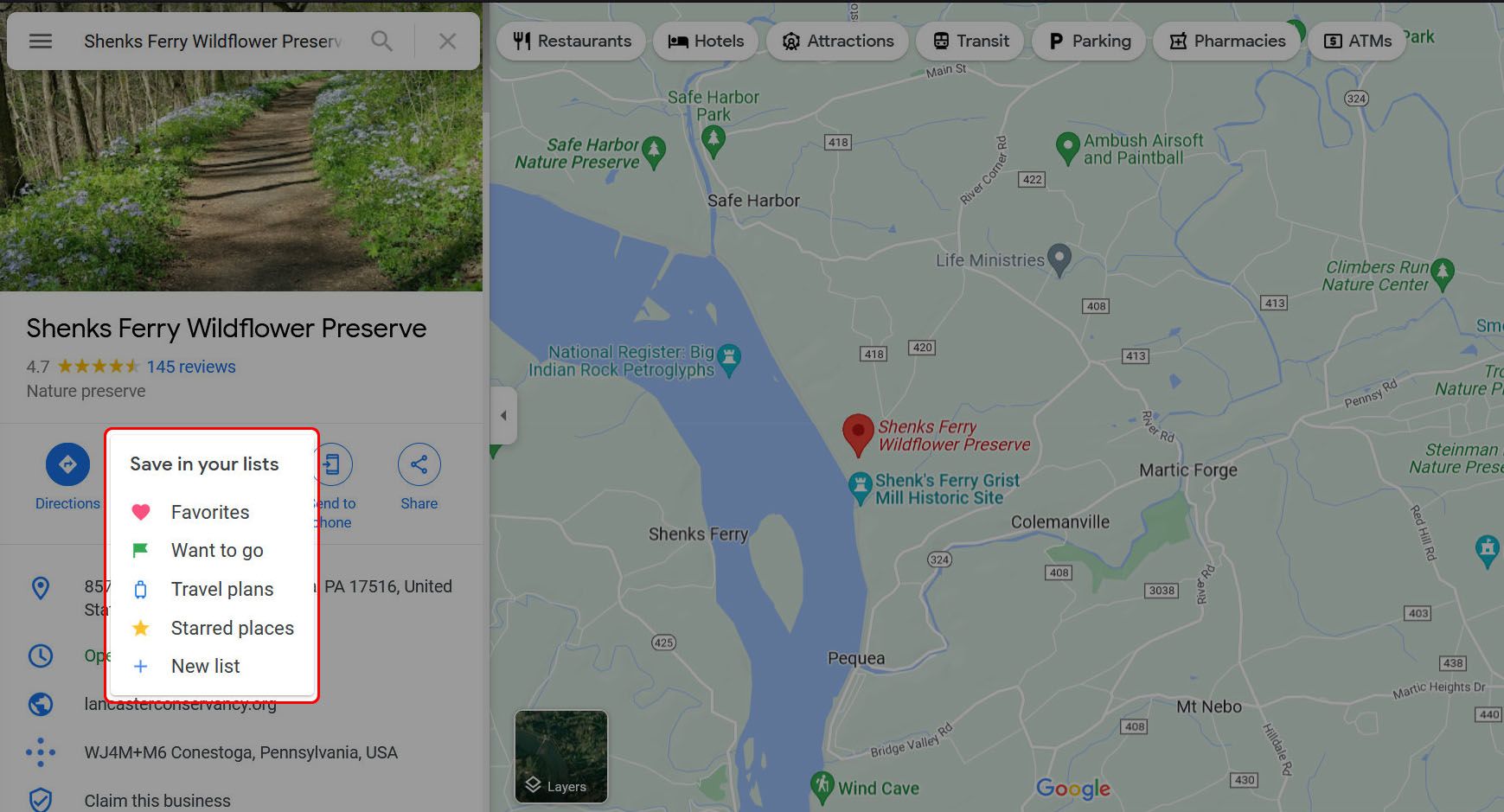
Mark your favorite places in Google Maps
If you go to enough places, you're bound to find a few that you like more than the others. They're the kinds of places that you keep coming back to. To make it easy for Maps to take you back to these places, put them in a list of favorite places. Dropping a pin is one of our favorite Google Maps features, and we have a more in-depth guide to Google Map pins and Google My Maps.
To save a location on desktop or mobile:
- Select a place or set of coordinates.
-
Click Save.
-
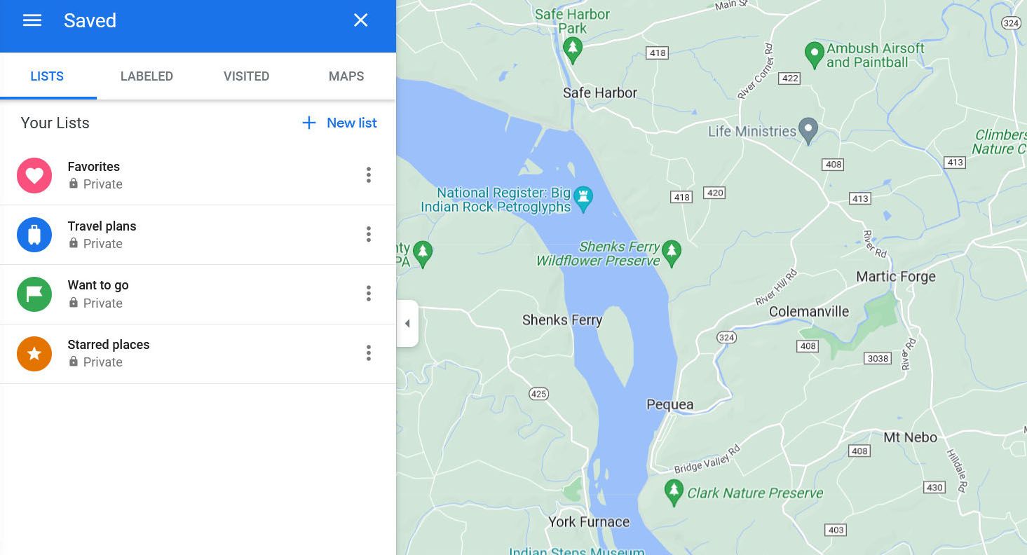
Choose or create a list in which to save your place.


In the mobile app, your favorite places are pinned on your map with an icon according to which list they were put in.
Accessing your list of favorites involves a couple of steps. Still, it's faster than typing or pinching and zooming.
On your desktop, follow these steps:
- Click on the three-bar menu in the upper-left corner.
-
Select Your places.
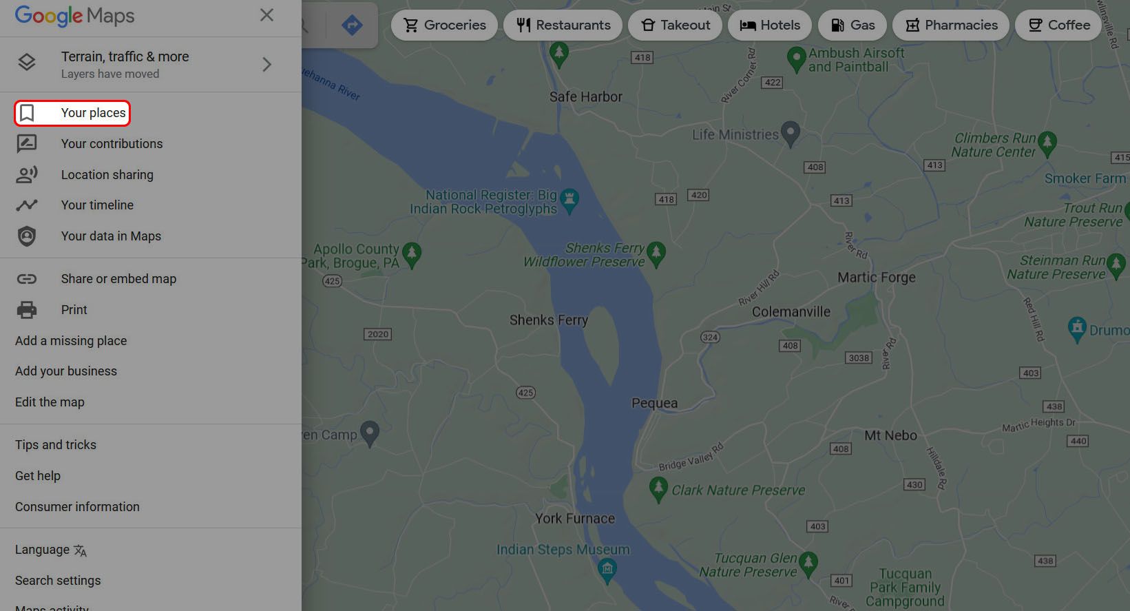
-
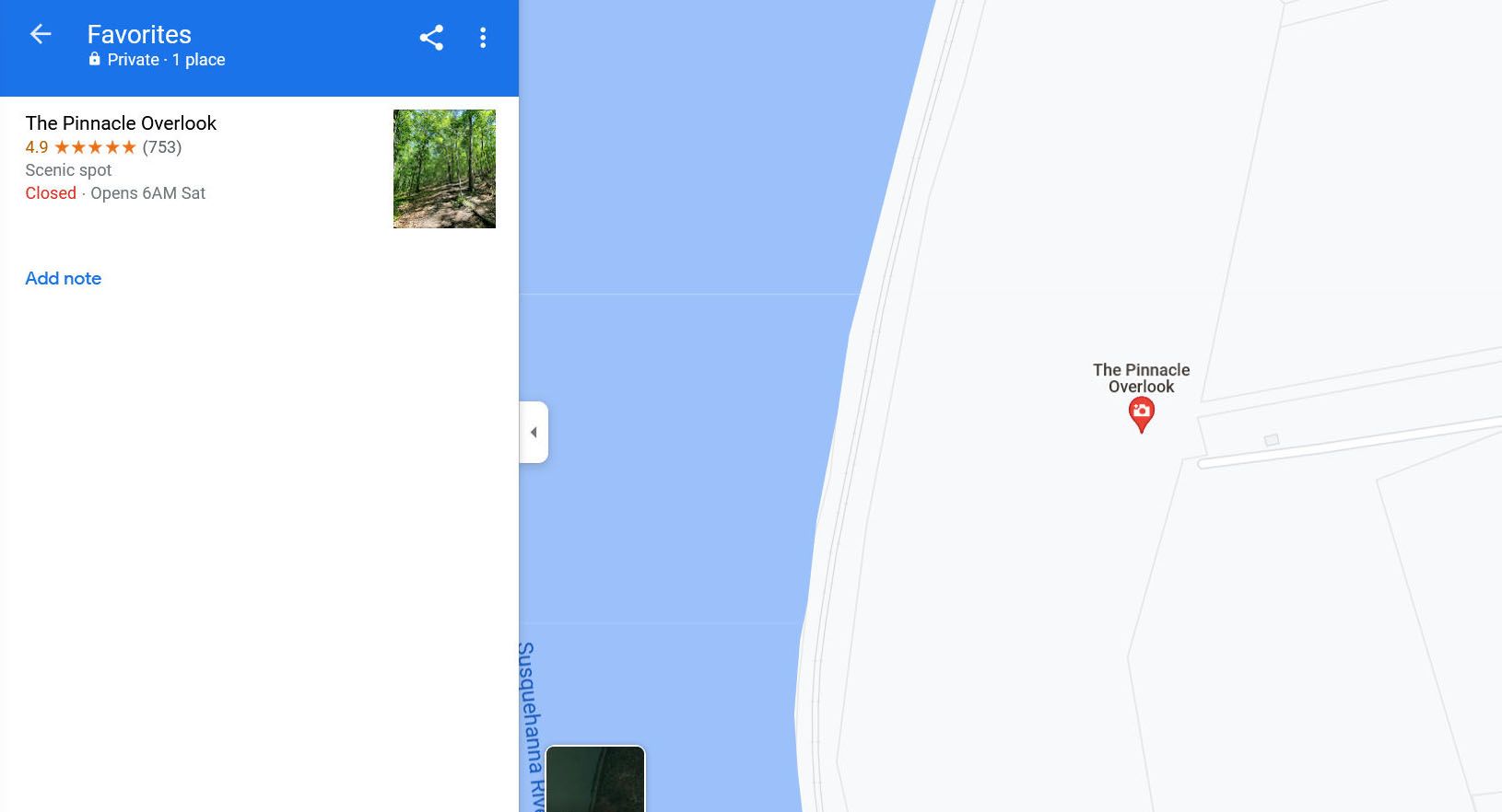
Choose the list with the saved place you're looking for.
-
Select the saved location.


On mobile, the process is the same, except tap the Saved button at the bottom of the screen to access your list of saved places.


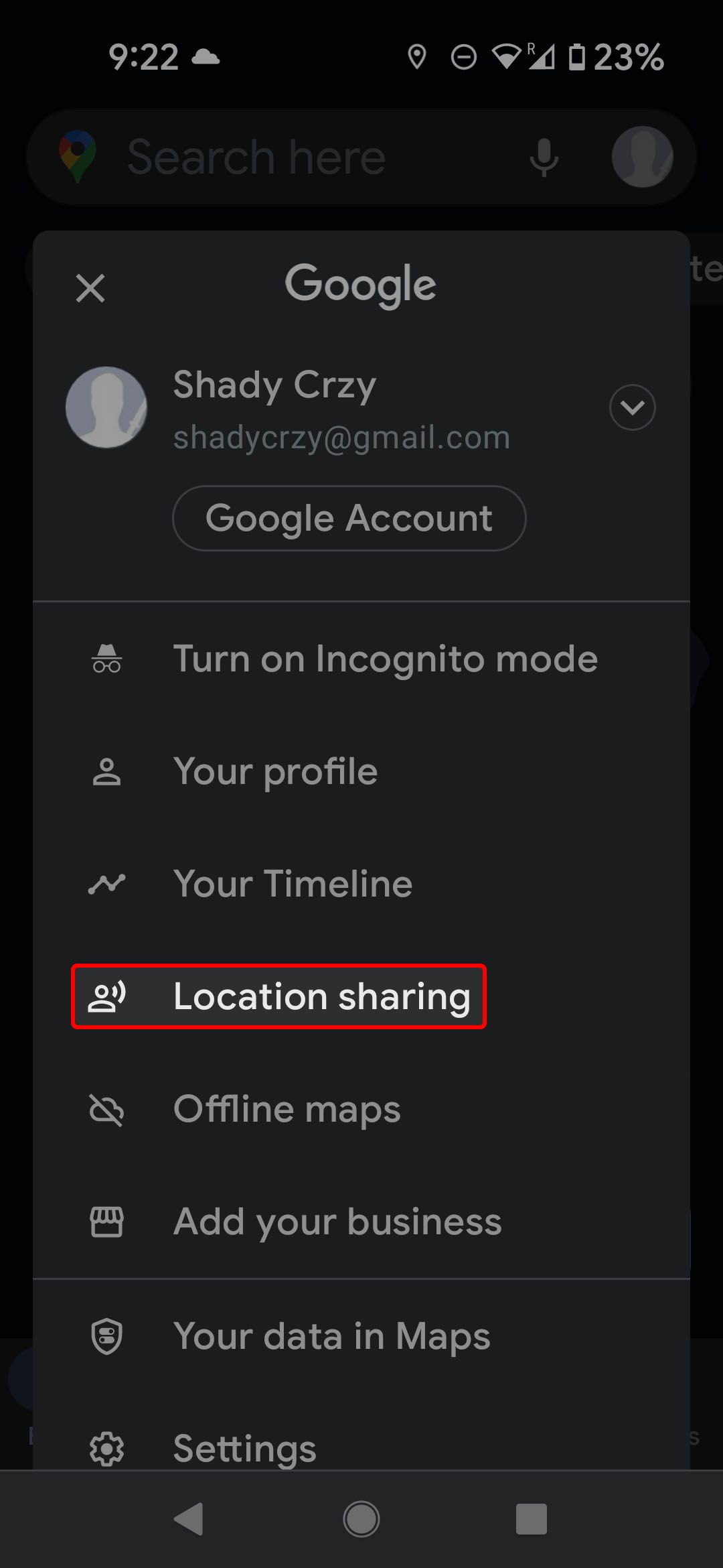
Share your location in Google Maps
Using a map to get to your destination is all well and good, but what if you need to let someone else know where you are? Google Maps has a handy feature for sharing your live location with someone for a set time. This only works if the person you're sharing with has a Google account.
- Tap your profile picture in the upper-right corner.
- Select Location sharing.
-
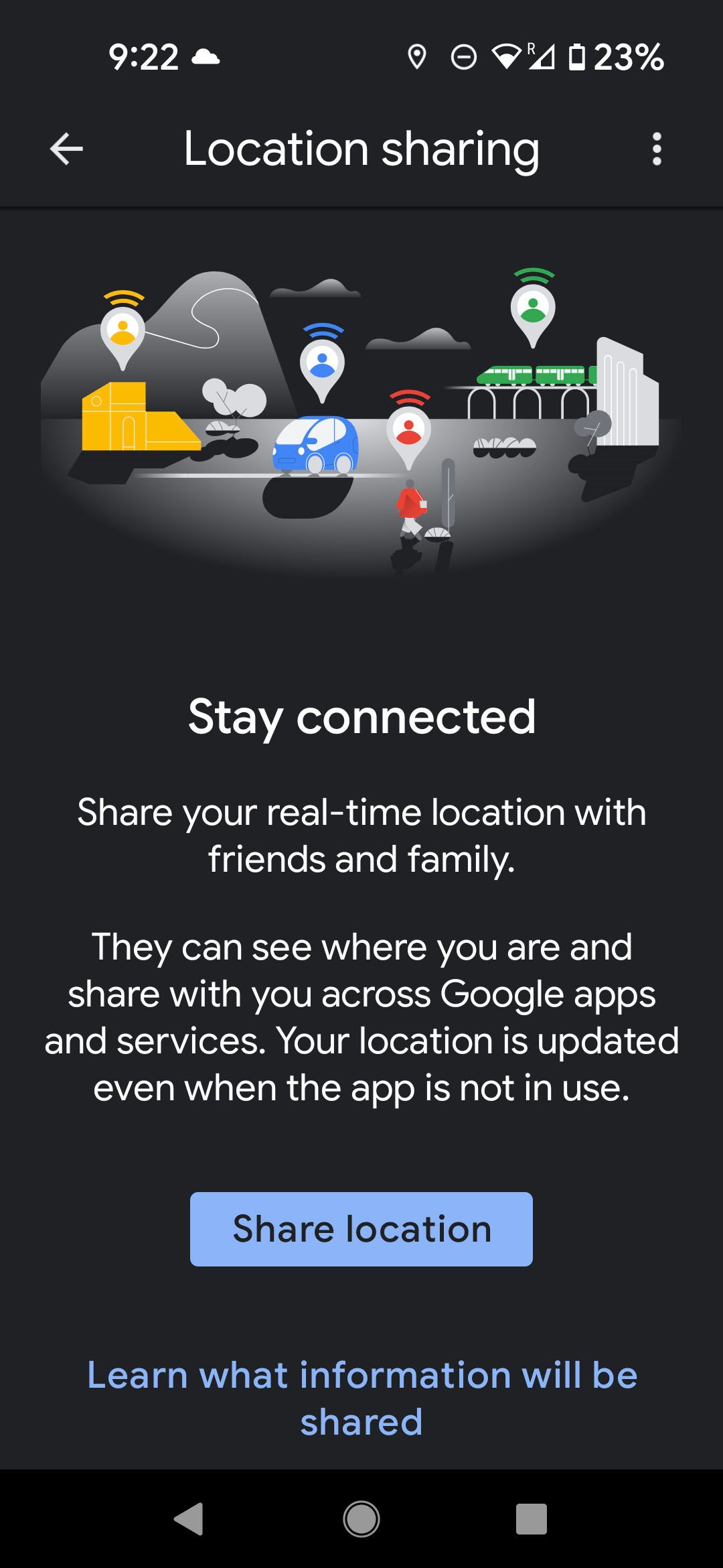
Tap the Share location button.
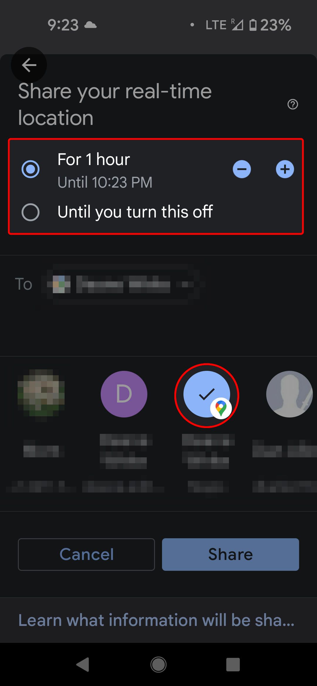
- Choose how long you'd like to share your location.
- Select the person you wish to share with (connections whose Gmail addresses are in your contact list have the Google Maps icon over their image).
-
Tap Share.
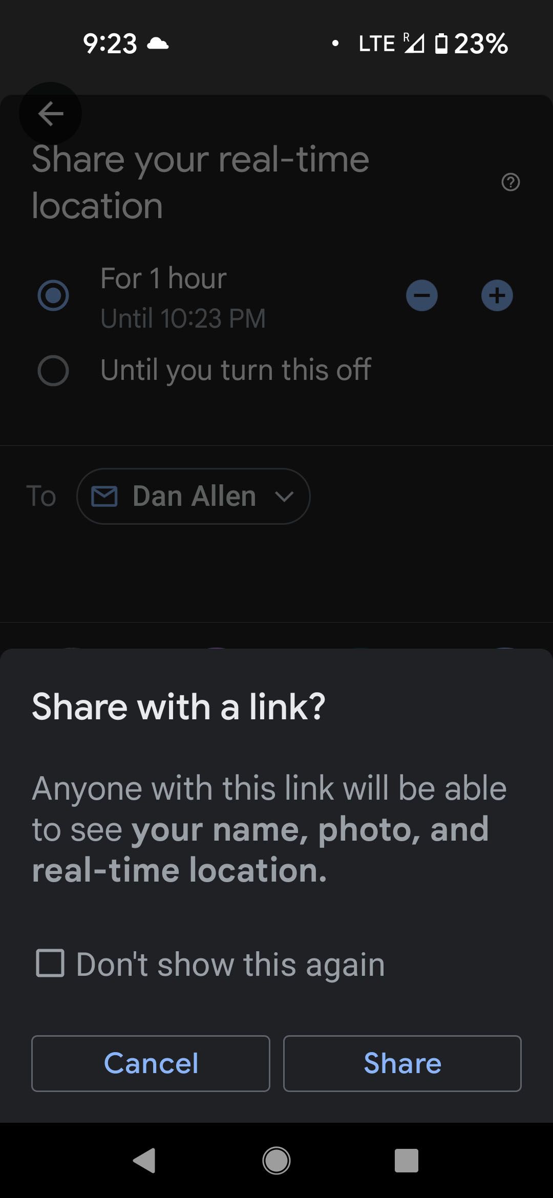


If the Gmail address of the person you'd like to share with isn't in your contacts list, you can still share your location. Instead of sharing directly via your Google account, Maps provides a link that you can copy and share however you like.
Use Google Maps to find public transportation details
Driving is cool and all, but sometimes you may prefer to take public transit. Instead of going to the transit authority website and looking up bus and train times, Use Google Maps. Maps has transit schedules and route options in most major cities.
The steps to take advantage of this are the same on desktop and mobile:
- Set up a route in Google Maps.
-
Select Transit as your preferred method of travel.
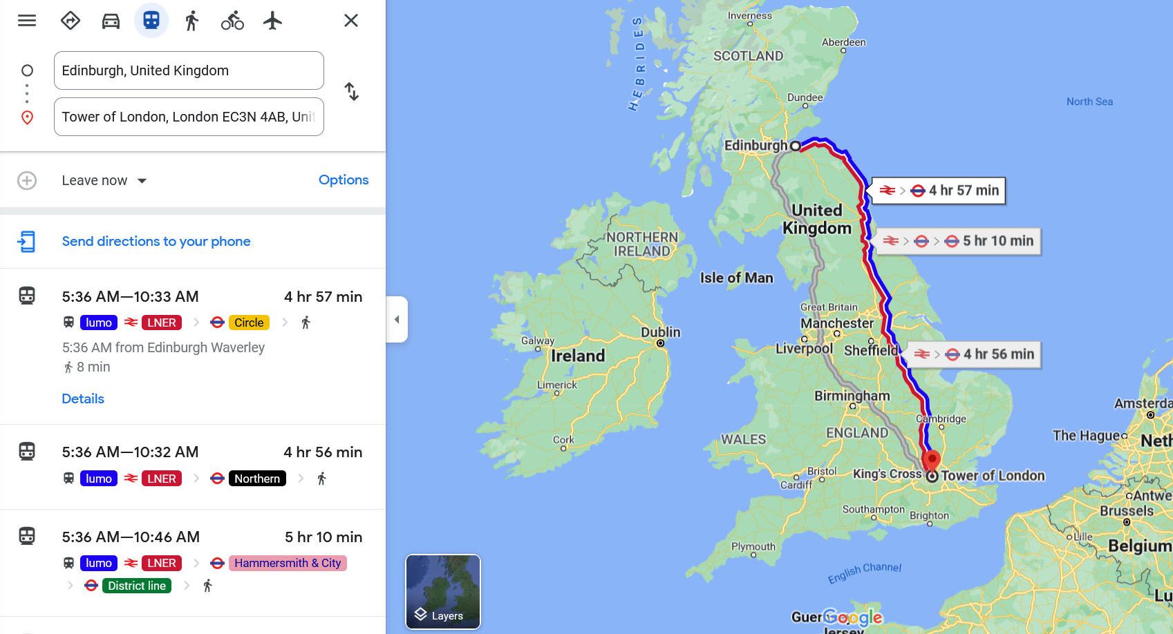

Maps shows a timetable of when the next train, bus, or ferry is leaving, as well as any connections you must make.
Use Google Maps to plan your next trip
There's more you can do with Google Maps. For example, you can use various Google services to plan your next vacation. And when you want to save a memorable spot you come across while traveling, drop a pin on your map to save that location or share it with friends.