There's an app on your phone with maps of what's going on at ground level, but what about in the air? If you're going to fly a drone around, as people are increasingly doing, it might be nice to know how close you are to obstacles and where you're not supposed to fly. That's what Hivemapper does, and it's available on Android now.
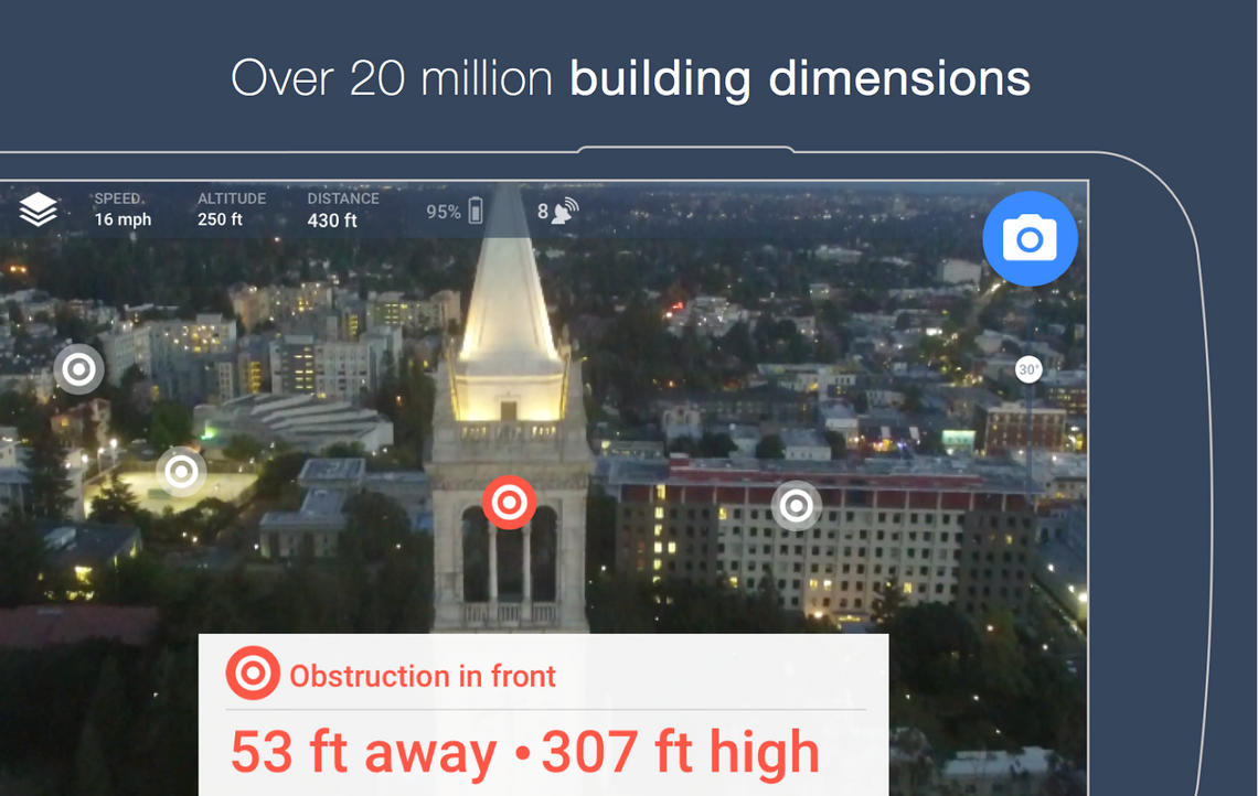
Hivemapper includes over 20 million building boundaries at launch, but only half of those include the building's height. There are also 16,000 no-fly zones for places like airports, government buildings, and so on. If you just want to find something cool, there are 15 million points of interest in the US that you can guide your drone to via the app.
In order to use Hivemapper, you need to have a compatible drone. Right now that means only the DJI Phantom 3, Phantom 2, and Inspire 1. Users of the app can submit additional details about the friendly skies like points of interest and areas where someone might shoot your drone out of the sky.